The puu in the last post is near the easternmost part of the island chain, and also where the Rift Zone enters the ocean. (photo courtesy of the USGS) That hill is in the backgound of this photo.

It has been awhile since I'd been down to this end of the island, I remembered the roads being in not too good shape. Well I am pleased to say that the county road crews have done a great job of fixing them up, and no twisties were destroyed in the process! Well, not TOO many... All along the coast road are sections of the old highway they left to give people access to the ocean. At this one there was a young couple on the rocks smoking pakalolo and a couple old local guys fishing.

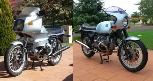
I was feeling a bit creative myself, and came up with this, my new motorcycling photos avatar:

A few more miles down the road I came across this tree tunnel. This is a photo I've been meaning to get ever since the "Interesting Road Photos" were posted in another thread.

Do you think this qualifies as an interesting road photo?

At the end of this road used to be the town of Kalapana and its famous black sand beach. In the next photo my R75/5 is sitting on pahoehoe lava, about 8 feet above where the beach used to be. The current beach is another 1/4 mile further out from the old shoreline.

The eruption that created these flows is still going on, over 20 years now. I know you can't see it, but there is a plume of steam in the distance, directly above my bike, where the lava is entering the ocean.
 This is still a very volcanically active part of the island, huge cracks have formed where the island is literally buckling and cracking (more about that, later). This stand of tall trees is very close to the state park:
  Past the Rift Zone the island quickly drops in elevation to the ocean through an area of small farms and subdivisions. In the next photo you can see fallow sugarcane fields on the left and a producing papaya plantation on the right. The puu (cinder cone) in the distance is on the coastline. Not visible is a lava flow to the right that wiped out the town of Opihikao back in 1960.
  More to come...
 This is known as The Great Crack, and geologists surmise that at some point this end of the island will fall into the ocean. That ought to make some BIG waves! Here's an aerial photo of the same area (photo courtesy of the USGS)
  For more pictures of the volcanos in action check out
  The main highway passes overhead on the bridge visible in this photo. Further up the old two laner is the old town of Waiohinu, plenty old buildings, mostly galleries now.
  All day I had been mostly successful in dodging the raindrops, but on the way home I hit a major downpour going up the hill out of Honokaa, but it was no big thing. Home in half an hour! The island really needs the rain, so we really don't mind. Hope you enjoyed these photos.